
Curiosity Blog, Sols 5016–5021: Fantastic Minerals and How To Detect Them
Written by Lucy Lim, Planetary Scientist at NASA Goddard Space Flight Center
Earth planning date: Friday, Sept. 18, 2026
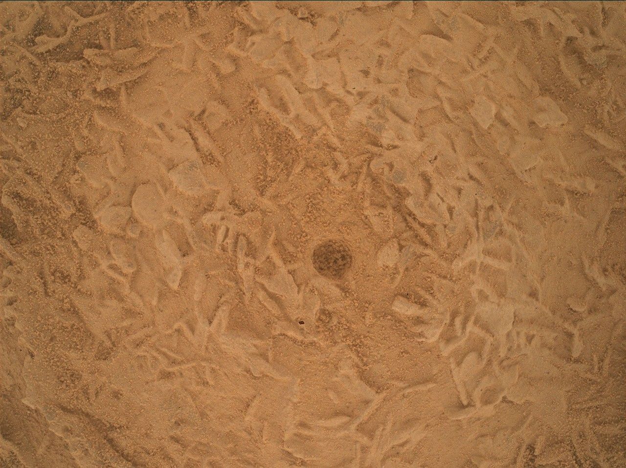
Curiosity surprised us at the beginning of the week with a change in rock texture — instead of the finely layered bedrock blocks we've been seeing in our recent sulfate unit workspaces, suddenly we were looking at blocks covered (and likely filled) with a jumble of small disc-shaped lumps. We've seen somewhat similar features before much earlier in the mission — for example, close to the Pahrump Hills back in the Murray mudstones, and they're sometimes seen in Earth rocks as well, especially in settings in which minerals were precipitating from an evaporating fluid. The disc-like shapes could be created by the growth habits of a specific crystalline mineral that is known to grow into similar shapes, or they could be bits of a harder rock layer that broke up and collected here. We planned Mastcam and MAHLI imaging for more morphological detail on the jumbled disc blocks (“Yungay,” “Chiu Chiu”) as well as LIBS (“Puya Raimondii,” “Liolaemus Tacnae,” “Pisqu Warkatana”) and APXS (“Salar de Vacas”) to investigate their composition.
Ongoing long-distance imaging projects were furthered by ChemCam long-distance remote imager (RMI) and Mastcam mosaics of the buttes on either side of Valle Grande. These “cutaway”-view images of the strata above the rover will help us map sedimentary structures in these upcoming units and understand how these rocks formed and eroded. Views of more recent erosional deposits will also help us to understand the formation of Valle Grande itself.
In order to identify minerals, Curiosity needs data from the CheMin X-ray diffraction instrument, which means a drill campaign. We've driven over a kilometer since our last drill site at Campo Marte, and this will be our first drill above the erosional supersurface. The Wednesday plan's drive brought us up next to a promising drill workspace a little beyond where we saw the disc-shaped features discussed above (imaged as “Torres del Paine” by Mastcam) and Friday’s planning included site characterization with the instruments on Curiosity's arm (“Alberta Wild Rose,” “Moonraker Mountain”), ChemCam LIBS (“Osoyoos”), and Mastcam (“Trincomali Channel,” “Yellow Lady's Slipper”). The team also selected a specific drill target and planned a very short drive to bring it in range of the arm — first for contact science and then, if all goes well, for the preload test and drill.
I'll be back on planning on Monday as Geology and Mineralogy Science Theme Lead for Drill Sol 1 (Triage Contact Science) and we’ll see how things go from there!
Visit Mission Updates
Visit the Science Instruments page
Full text from nasa.gov (public domain).